
Barrington students are giants of geography
Sowams School students' projects featured on huge traveling map
There is a huge map covering the classroom floor.
The map — it is made of a light plastic material — has been all over the state, in classrooms from Kingston to Warwick. Most …
This item is available in full to subscribers.
Please log in to continue |
Register to post eventsIf you'd like to post an event to our calendar, you can create a free account by clicking here. Note that free accounts do not have access to our subscriber-only content. |
Day pass subscribers
Are you a day pass subscriber who needs to log in? Click here to continue.
Barrington students are giants of geography
Sowams School students' projects featured on huge traveling map


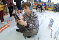

There is a huge map covering the classroom floor.
The map — it is made of a light plastic material — has been all over the state, in classrooms from Kingston to Warwick. Most recently, the map made a visit to Sowams School in Barrington.
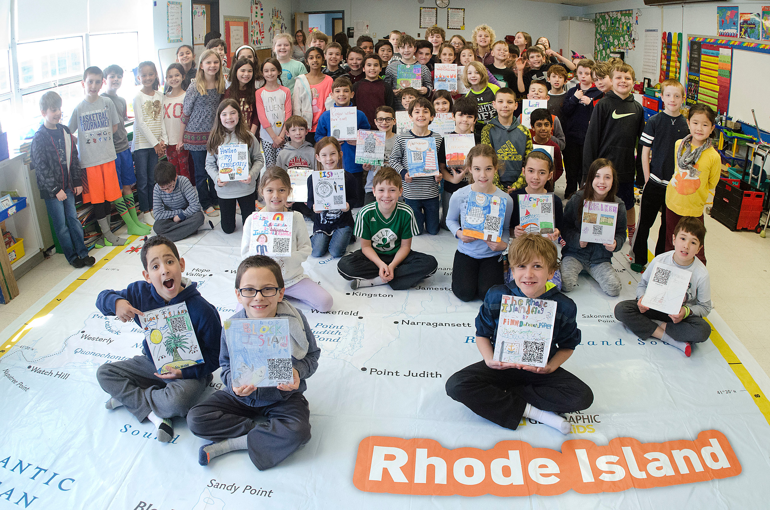
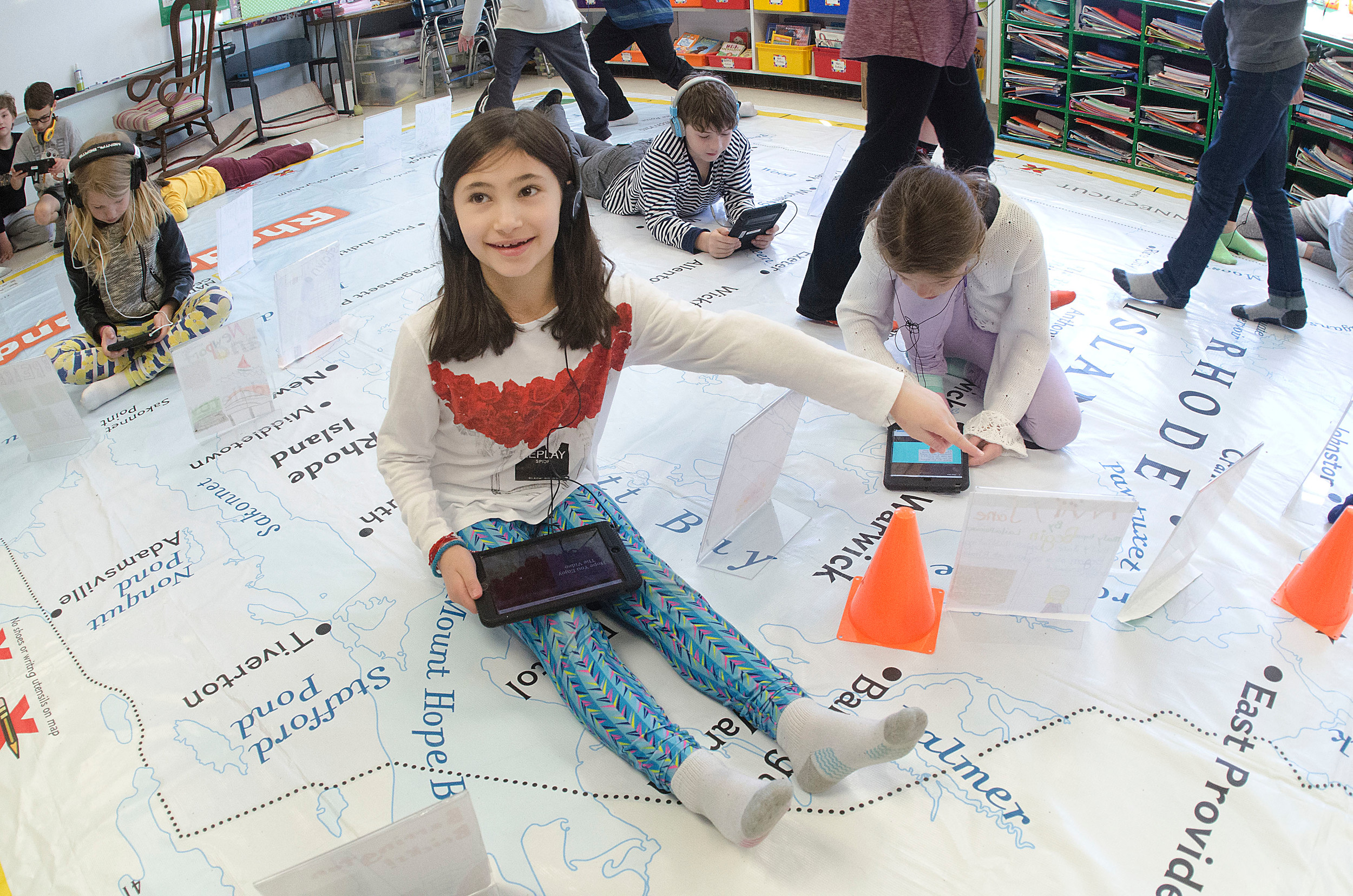
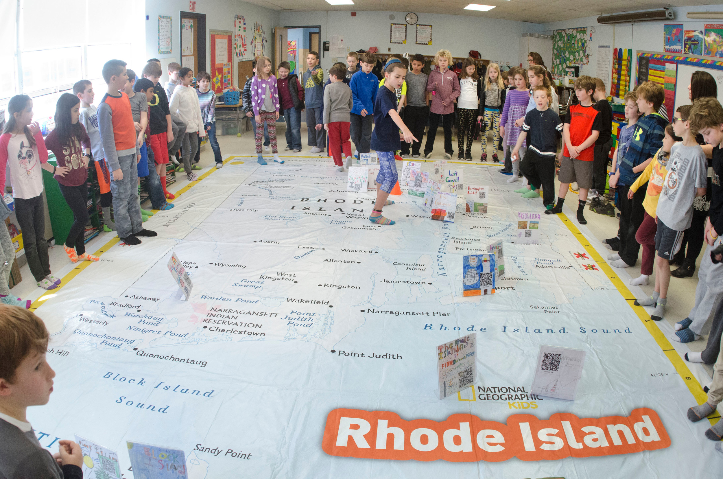
The map, which displays a 16-foot-by-24-foot state of Rhode Island, is spread across the floor in Ms. Fagan's room, and spread across the map are dozens of third-graders.
Each of the students is carrying an electronic tablet and wearing headphones.
As the students approach special placards on the map, they carefully position the tablets above a small "quick response" code, or QR code, and scan the marker.
Instantly the screen of the tablet fills with the first page of a student-created project featuring something about the Ocean State.
The Rhode Island Geography Education Alliance offered schools across the state the chance to borrow the map in an effort to help teach young students about the state.
At Sowams, students researched and created presentations about the Ocean State — one group in Jenny Gaynor's class focused on all things Newport, while another made a presentation about the Hasbro toy company, and a third created a project about Barrington bricks.
One student shared his group's focus: The Independent Man atop the Rhode Island Statehouse.
"It has been struck by lightning 27 times," added the student.
The third grade classes for Jenny Gaynor, Susan Fagan and Kathryn Carey were all involved in the project.
The traveling map was schedule to stay at Sowams School through Friday, April 14. Ms. Gaynor said the map allowed the students to complete some "project based learning."


