
Winter isn't over yet; snowstorm approaches
As much as 7 inches if forecast to fall across the region overnight Thursday through Friday morning
During a sunny day with temperatures in the mid-50s Thursday, one could be forgiven for thinking we've put winter in the rear-view mirror
Not so fast.
Winter returns Thursday night and Friday …
This item is available in full to subscribers.
Please log in to continue |
Register to post eventsIf you'd like to post an event to our calendar, you can create a free account by clicking here. Note that free accounts do not have access to our subscriber-only content. |
Day pass subscribers
Are you a day pass subscriber who needs to log in? Click here to continue.
Winter isn't over yet; snowstorm approaches
As much as 7 inches if forecast to fall across the region overnight Thursday through Friday morning
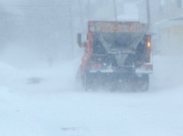
During a sunny day with temperatures in the mid-50s Thursday, one could be forgiven for thinking we've put winter in the rear-view mirror
Not so fast.
Winter returns Thursday night and Friday morning, dumping upwards of 7 inches of snow across the region before tapering off early Friday afternoon. The National Weather Service has issued a winter storm watch for the area through Friday afternoon. A gale warning is also in place as gusts as high as 45 mph are likely through Thursday.
Temperatures will plummet Thursday evening from a high of 55 into the 20s. The snow is expected to begin around 1 a.m., continuing through Friday morning before coming to an end around 2 p.m. The National Weather Service is calling for 4-7 inches to fall across the region.
Frigid air will move in after the storm, dropping temperatures into the single digits by Saturday. It'll be cold but sunny through Sunday and Monday with temps in the 20s and teens before another round of snow hits Tuesday. It's too early to determine snowfall amounts Tuesday.
Parking bans are likely across the region, and some have been issued already. Portsmouth's is to begin at 3 a.m. Friday. In Bristol, cars must be off the streets by 6 a.m. Friday.
School calcelations are also possible Friday. Check back with eastbayri.com for more information as it becomes available.
Keywords
National Weather Service, winter storm watch


