- TUESDAY, JULY 16, 2024
Portsmouth council hears tide of opposition to shoreline access bill
Waterfront property owners’ claim it would result in ‘land-taking’ is refuted by measure’s primary sponsor, Rep. Terri Cortvriend
PORTSMOUTH — Proposed state legislation intended to clarify just where people are allowed to move along a shoreline failed to find support from the Town Council Monday night after numerous …
This item is available in full to subscribers.
Please log in to continue |
Register to post eventsIf you'd like to post an event to our calendar, you can create a free account by clicking here. Note that free accounts do not have access to our subscriber-only content. |
Day pass subscribers
Are you a day pass subscriber who needs to log in? Click here to continue.
Portsmouth council hears tide of opposition to shoreline access bill
Waterfront property owners’ claim it would result in ‘land-taking’ is refuted by measure’s primary sponsor, Rep. Terri Cortvriend

PORTSMOUTH — Proposed state legislation intended to clarify just where people are allowed to move along a shoreline failed to find support from the Town Council Monday night after numerous waterfront property owners blasted the measure during an often-contentious debate that lasted nearly two hours.
At issue is a bill in the R.I. House of Representatives, 2023-H5174, sponsored by Rep. Terri Cortvriend (D-Dist. 72-Portsmouth, Middletown) and several others. The measure has yet to have a hearing at the State House, but has already stirred up considerable opposition from many Portsmouth waterfront property owners who say it will empower more beach visitors to traverse their property, litter, and pose a potential liability risk.
Opponents also charged that the bill, which would allow the public to exercise their “rights and privileges” of an existing shore, “on wet sand or dry sand or rocky beach, up to six feet landward of the recognizable high tide line,” amounts to a taking of land from beachfront property owners.
Cortvriend’s heard the objections but still defends the bill, which she said was written in response to the confusion, conflict and disputes that have arisen over the years between members of the public exercising their rights to the shore and the rights of property owners along the shore.
The bill came out of a 12-member House study commission Cortvriend chaired that was formed to make recommendations on issues relating to “lateral access” along the Rhode Island shoreline. The panel, which included a retired state Supreme Court justice, representatives from the Coastal Resources Management Council and Save the Bay, marine affairs professors from the University of Rhode Island Roger Williams University, a land use attorney, a Realtor, land surveyor, coastal community resident, and a representative from the R.I. Attorney General’s Office with experience in shoreline access issues, first convened in August 2021 and issued a final report in March 2022. You can read the commission's full report here.
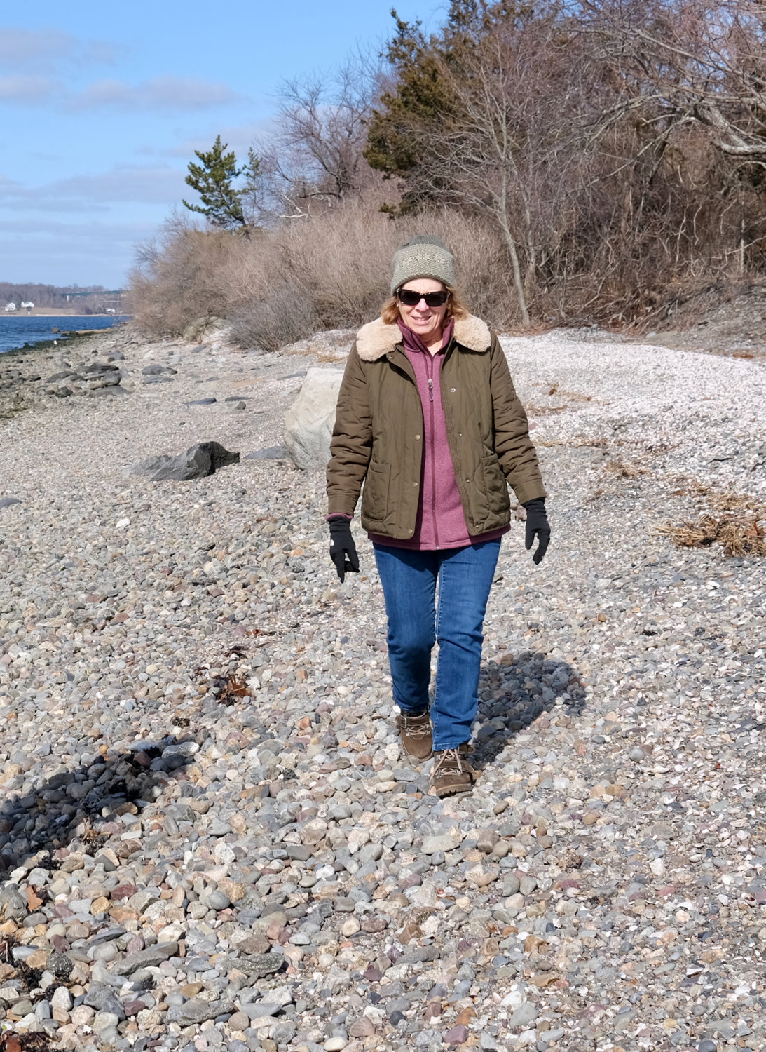
“The bill is trying to identify, for property owners and the public, where they can exercise the rights that are guaranteed to them, explicitly mentioned in the Constitution — the where,” she said after a weekend walk along a rocky shoreline on the west side of town. “We’re not creating a zone of lawlessness. If it’s illegal now, it remains illegal. There’s also a clause in the bill protecting property owners from liability.
“They’re concerned about people coming on to their lawns, which is not enabled in the bill. They’re concerned about people passing through their yards for access. This is only about lateral access; you have to come down a legal right of way to be on the shore in the first place. For legally constructed seawalls, there’s an exemption; there’s no access on them. Members of the public are able to access only “the passable sandy, rocky shore … There are places where the shore is not passable, and that’s just the way it is.”
The bill is not to be confused with a different one: 2023-H5116, for which Rep. Joseph McNamara (D-Dist. 19) is the primary sponsor. That measure would permit the director of the R.I. Department of Environmental Management to recognize and identify public rights-of-way to shoreline and water access over land owned by a private party. Cortvriend is also a secondary sponsor of that bill, but said H5174 has to do with “lateral” access to the shore, while H5116 is more about “perpendicular” access — how one legally gets to the shore in the first place.
Monday’s discussion was specifically about whether the Town Council should support a Charlestown Town Council resolution that urges passage of H5174.
“It is in the best interests of the health, safety and welfare of the people and visitors to Rhode Island and the Town of Charlestown to enact a workable, readily identifiable right of access to the shore by the public to prevent confusion, conflict and disputes between those attending to exercise their rights and privileges to the shoreline and the rights of shoreline property owners,” stated the Charlestown resolution.
The Charlestown resolution appeared in the council’s correspondence for its Feb. 27 meeting, and council member Charles Levesque pulled it for discussion and action on Monday. (Any item under “correspondence” cannot be discussed or acted upon unless it’s pulled from that section of the agenda and placed under the “business” part of a future meeting docket for public discussion.)
After hearing from everyone on Monday, Levesque made a motion to support the resolution, but it died after failing to get a second.
“This is an attempt to get a solid basis for what the rights and competing rights are,” Levesque said at the start of the discussion. “It’s not the only way to to this. I personally feel it’s the best way to do it.”
Council member Keith Hamilton told Cortvriend that one of the main concerns about the bill is that “it doesn’t really delineate where the access comes from.” He asked whether language such as “access by a public right of way” would be added to the bill, and Cortvriend agreed to bring his suggestion back to her colleagues for consideration.
A ‘taking of land?’
Council members then opened up discussion to the public, and they got an earful. More than a dozen residents, nearly all of them waterfront property owners, spoke out.
Amanda Carr of Baker Road, which skirts the west shoreline between the Carnegie development and the Pheasant Drive area, said she already has people traversing her backyard, camping and sitting on her seawall. If the bill becomes law, things will get even worse, she said.
“When global warming raises the sea level, the mean high tide will rise. My property ends at the mean high tide, period. Why does it need to be six feet farther than that?” Carr asked. “Six feet of land — you can take that off my taxes.”
Donato D’Andrea, an attorney from Newport whose family has owned property on Baker Road since 1959, said he doesn’t believe the bill would impact his Portsmouth property, but spoke out against the legislation anyway.
“This legislation, by moving where the mean high tide is, constitutes taking land, for which the landowner has to be compensated,” D’Andrea said, adding it could also negatively impact property values.
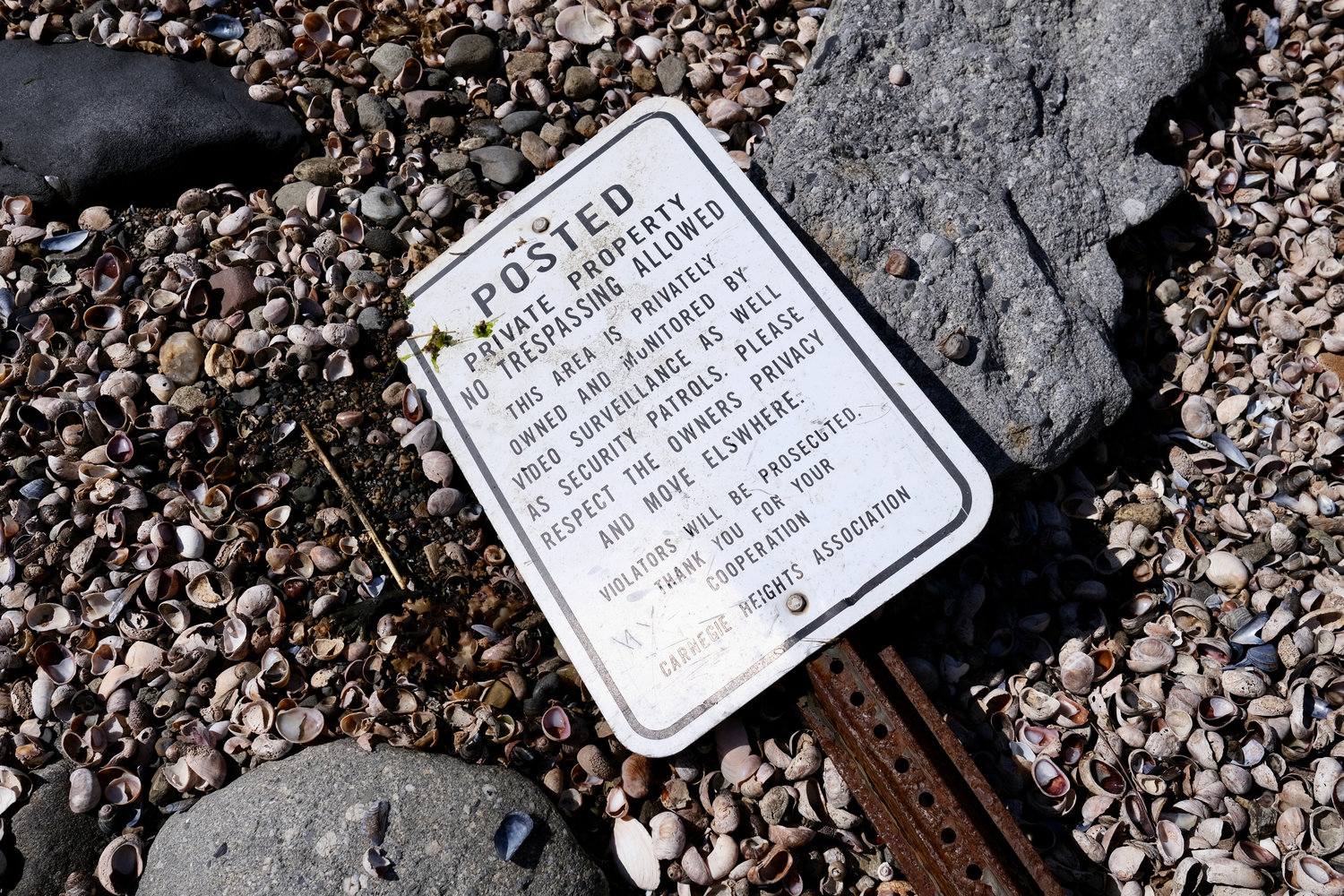
Paul Laurienzo, of Thayer Drive, also said the bill amounted to a land-taking. “My deed says I own property that you tax me on to the nearest high tide mark. I do have liability problems. My insurance company has asked me to put up no-trespassing signs,” he said. “I don’t want my property taken and I don’t want an argument with people who could say, ‘Oh, I can go on your property.’”
Laurienzo also charged that Cortvriend’s bill seems to address residents of Charlestown more than in Portsmouth. “I would expect my representative to represent Portsmouth,” he said.
Later on in the meeting, Cortvriend said the attorney general’s representative on the study commission said the bill wouldn’t amount to a taking of land, and that the AG would defend that matter in court if necessary.
Larry Walsh, of Bayview Avenue, said two members of the House study commission admitted its recommendations were based on ocean-facing beaches, rather than those in the upper bay like Portsmouth.
“I’m not sure why the Town of Portsmouth, that’s in the upper bay, would want a law passed that’s really based on 40 miles of beachfront, when there’s another 360 miles of waterfront that’s going to be affected,” Walsh said. “I think this will just give people an implied right that they might not understand, but they’re going to take advantage of this and do what they want.”
Tom Grieb is a Thayer Drive resident and member of the Harbor Commission, which voted March 1 to not accept the bill as written. He suggested either adding six feet landward to whatever the water line is at any given time, or following CRMC’s most recent shoreline map that the Harbor Commission has used to solve disputes. The mean high tide mark “is ill-defined even in this bill,” Grieb said.
He also charged that the legislation will do nothing to solve the “bad behavior” exhibited by many beach visitors.
Diana Ouellette, of Mussel Bed Shoal Road, agreed with his second point. Visitors to the shore in front of her house already camp out well past the six-foot line. There are no facilities and they often stay there all day, said Ouellette, noting she calls one tree “the poop tree” because she’s always finding soiled toilet paper around it.
After Levesque’s motion to support the Charlestown resolution failed to get a second, council member Daniela Abbott commented that the only thing made clear during the discussion “is that the Town Council should not vote on this. As we saw tonight, there’s a whole laundry list of issues that need to be aired out at the State House. I would vote we don’t vote on it.”
The council took no action, prompting applause from most of those in attendance.
Defenders speak out
Levesque said almost everything he heard Monday had to do with people behaving badly after using a legal right of way. “But those are different problems … as opposed to people having access,” he said.
Besides Cortvriend and Levesque, the only other person to speak in favor of the bill was Topher Hamblett, director of advocacy for Save The Bay, who served on the House study commission. “I can tell you the process was very rigorous,” said Hamblett, noting that scientists who worked with the commission said that most of the time during its 18.6-year metonic cycle, the mean high water mark is underwater.
“What (the bill) does do is restore a right that has been (lost over the years) through rising seas,” he said. CRMC would have to engage in “intensive education” and use signage as part of the process. The bill doesn’t make any current illegal activity legal, he added.
Following the meeting, Cortvriend said she was disappointed with all the negative comments about her bill, but that it was a complicated topic and much of what she heard was inaccurate.
“Analysis by the scientists at URI’s Coastal Institute has revealed that the continued use of the MHW (mean high water) standard, particularly in light of rapidly increasing sea level rise, amounts to a denial of the public’s constitutional rights to use the shore. It simply renders Rhode Islander’s rights and privileges of the shore illusory. The unintended consequence of using the MHW as the boundary has been a de facto taking from the public,” she said.
Cortvriend reminded residents that House bill 5174 has not been heard yet, so they are welcome to come to the State House and testify when it’s time. She suggested members of the public create an online account at the General Assembly’s “Bill Tracker” website and plug in any bills they’re interested in. When a hearing is scheduled, the user will be notified by e-mail.
Other items that may interest you


